Pakoon Springs

Clark County, Arizona · Near Bunkerville
36.4180°N, 113.9560°W · 2,300 ft
86°F 2,300 ft Open Short Walk Bureau of Land Management

Pakoon Springs flows at 86°F in the remote Arizona Strip country, emerging 18 degrees above the 68°F average at 2,300 feet elevation. The isolation and dramatic canyon landscape, combined with BLM management and open access, makes this spring accessible for visitors seeking remote backcountry thermal features.

Location

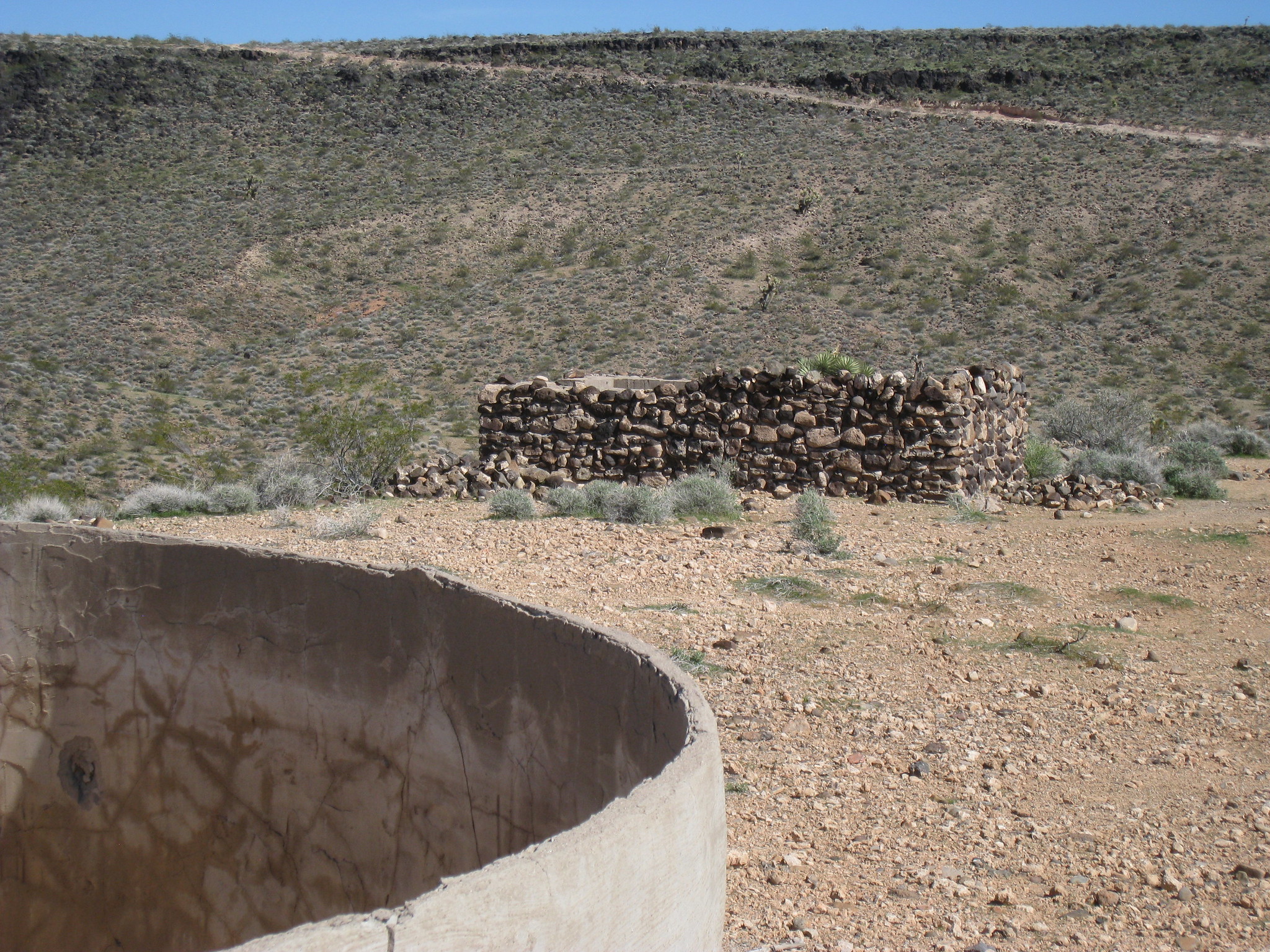
The spring requires a short 650-foot walk through canyon terrain where the Virgin Mountains meet the Grand Wash Cliffs, offering dramatic geological and scenic views. Sparse vegetation adapted to the semi-arid environment surrounds the feature, with extensive views across some of Arizona's most remote public lands. Rocky terrain and narrow canyons characterize the approach.

This remote spring requires determination to reach and is not suitable for casual visitors. Four-wheel drive vehicle access and backcountry hiking skills are essential. Visit during fall and spring to avoid summer heat and winter snow. Bring all supplies; services are extremely limited.

History of Pakoon Springs

Pakoon Springs emerges through fault systems in one of the geologically complex regions of the American Southwest, where the Basin and Range province creates alternating mountains and valleys. The Arizona Strip's isolation has preserved both geological features and cultural heritage from earlier inhabitants.

Monthly Climate
46°
Jan
50°
Feb
58°
Mar
67°
Apr
75°
May
88°
Jun
91°
Jul
90°
Aug
82°
Sep
69°
Oct
56°
Nov
45°
Dec
Annual Precip: 8.0 in Annual Snow: 2.3 in
Best Time to Visit
December Air 45°F · Water 86°F · +41° contrast
January Air 46°F · Water 86°F · +40° contrast
February Air 50°F · Water 86°F · +36° contrast
December offers 46°F more contrast than July
Current Conditions
86°F
SSE 12.8 mph 15%
Thursday 92° Low 57° Sunny
Friday 97° Low 61° Sunny
Saturday 100° Low 64° Sunny
Sunday 102° Low 64° Sunny
Monday 104° Low 66° Sunny
Water Chemistry Sampled 1975-05-11

The water at Pakoon Springs is slightly alkaline (pH 7.8).

pH 7.8 Slightly Alkaline
pH influences mineral absorption through skin
Calcium 48 mg/L
May support bone density and joint health
Magnesium 17 mg/L
Known for muscle relaxation and stress relief
Sodium 20 mg/L
Supports circulation and skin hydration
Sulfate 73 mg/L
Traditionally used for skin conditions and inflammation
Chloride 5 mg/L
Natural antiseptic with skin health benefits
Where to Stay

Some links are affiliate links. We may earn a commission at no extra cost to you.

Temperature
86°F
Warm Hot Boiling
Water Temp 86°F (30°C)
Avg Air Temp 68°F
Above Ambient +18°F
Warm air, warm water May
Access
Open
Road Access Short Walk
Distance to Road 0.1 mi
Land
Ownership Federal
Agency Bureau of Land Management
Designation PUB
Unit Arizona Strip Field Office
Manager Bureau of Land Management
Protection 3 - Protected, subject to extractive use
Frequently Asked Questions
What is the water temperature at Pakoon Springs?
Pakoon Springs has a water temperature of 86°F (30°C). This is a warm thermal spring.
Where is Pakoon Springs located?
Pakoon Springs is located in Clark County, Arizona at 2,300 feet elevation, near Bunkerville. Coordinates: 36.4180°N, 113.9560°W.
How do I get to Pakoon Springs?
Pakoon Springs has Short Walk road access (0.1 mi from the road).
Is Pakoon Springs free to visit?
Pakoon Springs has Open access. It is managed by Bureau of Land Management.
What minerals are in the water at Pakoon Springs?
Water chemistry analysis shows the presence of pH, Calcium, Magnesium, Sodium, Sulfate, Chloride. The pH is 7.8 (slightly alkaline).
Is it safe to soak at Pakoon Springs?
Pakoon Springs is generally safe for soaking at its recorded temperature. Always tell someone your plans before visiting remote hot springs.
Is Pakoon Springs crowded?
Pakoon Springs sees varying levels of visitors depending on the season and day of the week.
What should I bring to Pakoon Springs?
Essentials for Pakoon Springs: swimsuit, towel, water bottle, sun protection (hat, sunscreen), a trash bag to pack out what you pack in.
Sources: USGS NWIS