Anderson Springs, California
Anderson Springs community sits near thermal springs at 1,408 feet elevation in Lake County's forested hills, a settlement that developed around geothermal resources in the late 1800s.
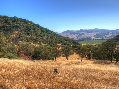
This roadside location near Rose Anderson Road sits in a landscape of oak and mixed forest at moderate elevation. The climate here receives substantial precipitation of 34.5 inches annually, creating lush vegetation and small streams that contrast with drier California regions. The community remains small and quiet.
Access is roadside along Rose Anderson Road in a semi-developed area. The community setting offers limited visitor infrastructure but represents an authentic piece of California's geothermal heritage. Nearby Warm Springs Recreation Area provides day-use facilities and a wider range of recreational opportunities.
The Anderson Springs area became known as a resort destination in the late 1800s when thermal springs first attracted visitors. The unincorporated community that grew around these geothermal features reflects California's wider pattern of settlement following natural hot water discoveries during the Gilded Age.
Some links are affiliate links. We may earn a commission at no extra cost to you.
Overview Warm Springs Recreation Area is a day-use park located at Lake Sonoma, which is just a 45 minute drive north of Santa Rosa and a 2 hour trip from San Francisco. There is no overnight camping available at this facility World famous vineyards and a land rich in history surround the lake, where visitors enjoy boating, fishing and exploring the area's extensive trail network.Recreation The Woodland Ridge Nature Trail begins at the park and winds up the ridge, rewarding hikers with great...
Anderson Springs, California is road-accessible, so you can bring more gear.


As an Amazon Associate, we earn from qualifying purchases.
Springs Near Anderson Springs, California
Hike 3 waterfalls near Anderson Springs, California
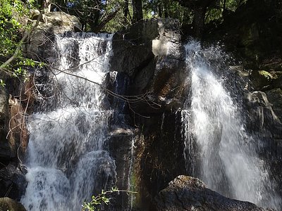
Looking for more outdoor adventures? Explore waterfall hikes near Anderson Springs, California, California.