Marble Hot Springs
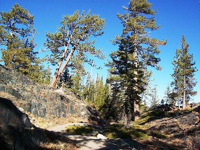
Marble Hot Springs sits at 4,883 feet elevation in the northern Sierra Nevada, just 59 feet from Marble Hot Springs Road near Portola in Plumas County. Though specific temperature data is unavailable, this named geothermal feature marked on OpenStreetMap offers roadside accessibility in scenic high-country terrain, with heavy winter snowfall exceeding 81 inches annually.
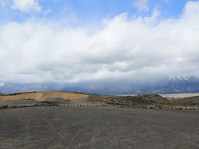
A short distance from Marble Hot Springs Road reaches this alpine spring at nearly 5,000 feet elevation. The setting combines mixed conifer forest with the characteristic terrain of the northern Sierra Nevada, where granite and metamorphic bedrock dominate. The spring's location near a named road suggests developed or semi-developed status in this high-country landscape.
Access is straightforward from Marble Hot Springs Road with minimal walking required. The high elevation (4,883 feet) means winter access is limited by heavy snowfall (81 inches annually). Summer (June-September) offers the practical visit window. The spring's specific characteristics and visitor facilities should be confirmed locally before planning a visit to this remote alpine location."
Marble Hot Springs sits in the geologically complex boundary zone between the Sierra Nevada batholith and the Cascade volcanic arc. The spring's presence indicates geothermal circulation in fractured bedrock at elevation. The area's name likely reflects local geology—either marble deposits or the distinctive white marble-colored mineral depositions sometimes found at alpine thermal springs.
Some links are affiliate links. We may earn a commission at no extra cost to you.
Overview Calpine is a forest fire lookout tower that was constructed in 1934 by the Civilian Conservation Corps, and is one of three remaining examples of the enclosed windmill-style lookout in California. The lookout was actively used every summer until 1975. It is a three-story structure with external stairs. The top room or observation cab is the only rentable space at this time. This is a popular rental facility that is booked almost every night of the year. Calpine sits at an elev...
Marble Hot Springs is road-accessible, so you can bring more gear.


As an Amazon Associate, we earn from qualifying purchases.
Springs Near Marble Hot Springs
Hike 6 waterfalls near Marble Hot Springs
Looking for more outdoor adventures? Explore waterfall hikes near Marble Hot Springs, California.