Soda Spring In Cache Formation
Soda Spring in Cache Formation flows at 72°F in Lake County's volcanic landscape, emerging from the geologically significant Cache Formation on Bureau of Land Management land.
The spring sits at 1,545 feet elevation near Clearlake, requiring a moderate 1,076-foot walk through natural landscape managed for conservation. The surrounding terrain reflects volcanic activity with varied topography, seasonal water features, and vegetation adapted to the region's 21.8 inches of annual precipitation.
The Bureau of Land Management maintains open public access with a short-walk approach. This location appeals to visitors exploring volcanic geology and remote natural areas. Little Stony Campground offers reservation-based camping 37 kilometers away for extended visits.
The spring emerges from the Cache Formation, a geologically distinctive volcanic deposit that influences groundwater circulation and temperature. The Ukiah Field Office manages this site with permanent protection under the Bureau of Land Management's conservation mandate.
Some links are affiliate links. We may earn a commission at no extra cost to you.
Overview This location is available on a first-come, first-served basis only. Visitors are required to physically arrive at the campground to purchase and claim a site.Once on-site, you are able to pay for your campsite(s) by scanning a QR code using the Recreation.gov mobile app, and the Scan and Pay feature.In order to utilize Scan & Pay on site, you will need to first download the free Recreation.gov mobile app https://www.recreation.gov/mobile-app prior to your arrival as some remote area...
Soda Spring In Cache Formation is road-accessible, so you can bring more gear.


As an Amazon Associate, we earn from qualifying purchases.
Springs Near Soda Spring In Cache Formation
More Springs Around 72°F
Hike 3 waterfalls near Soda Spring In Cache Formation
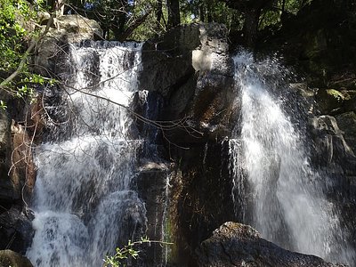
Looking for more outdoor adventures? Explore waterfall hikes near Soda Spring In Cache Formation, California.