Lefevre
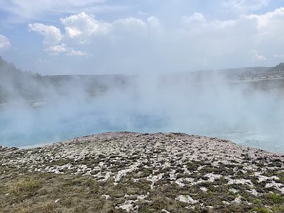
Lefevre Spring discharges at 90°F from BLM land at 6,460 feet elevation near Panguitch, accessible via a 441-meter walk from the nearest road. The spring runs 42 degrees above the 48°F ambient temperature in Garfield County's red rock country, where the Paunsaugunt Plateau meets the High Plateaus of Utah. Open access with no permits required on federal land managed by the Kanab Field Office.
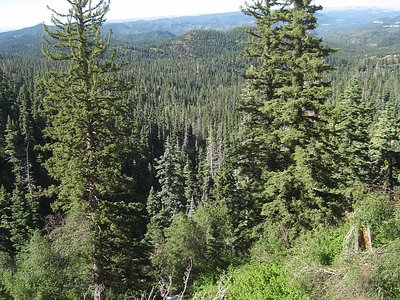
The spring emerges in spectacular slickrock terrain where Navajo Sandstone forms cliffs and domes characteristic of southern Utah's canyon country. At this elevation, ponderosa pine and gambel oak mix with pinyon-juniper woodland, and seasonal precipitation totals 13 inches with nearly 50 inches of snow. The surrounding landscape features vivid red, white, and orange sandstone layers sculpted by erosion. Nearby Panguitch Creek flows through a wooded canyon, supporting riparian cottonwood and willow. The area sits between the rim of Bryce Canyon to the east and the forested slopes of the Markagunt Plateau to the west, with volcanic rocks capping sedimentary formations.
Visit June through October when roads are passable and weather is favorable. Winter snow closes access and temperatures drop below zero. The 441-meter approach crosses BLM land—bring GPS and watch for loose rock on slickrock slopes. Water temperature at 90°F is warm enough for extended soaking if pools have formed. Afternoon thunderstorms are common July through September. White Bridge Campground 25 km away offers developed camping and access to Panguitch Creek fishing. Combine with visits to Bryce Canyon or exploring the Panguitch Lake ATV trail system.
The spring's name honors a French surname common among Mormon settlers in southern Utah, likely an early rancher or landowner in the Panguitch area. Ancestral Puebloan peoples and later Southern Paiute bands utilized these plateaus for hunting deer and elk. Mormon pioneers established Panguitch in 1864, developing logging and ranching operations in the high country. The BLM manages these lands for multiple use including grazing, recreation, and watershed protection. Thermal springs in this region reflect deep circulation through the Colorado Plateau's thick sedimentary sequences along fault zones.
Some links are affiliate links. We may earn a commission at no extra cost to you.
Overview White Bridge Campground is located just 12 miles southwest of Panguitch, Utah and 55 miles northeast of Cedar City. Visitors enjoy fishing, canoeing on nearby Panguitch Lake and exploring local trails.Recreation Campers enjoy fishing for rainbow trout in Panguitch Creek. Hiking and biking are popular activities around the campground. The Panguitch Lake ATV Trail System offers 100+ miles of trails and can be accessed nearby.Facilities White Bridge offers several family campsites. The...
Lefevre sits at 6,460 feet above sea level, way above the mile-high mark. You may not feel the altitude strongly, but hot water still dehydrates you faster at elevation. UV is about 26% stronger than at sea level, so bring sunscreen and drink more water than you normally would.


As an Amazon Associate, we earn from qualifying purchases.
Lefevre is road-accessible, so you can bring more gear.


As an Amazon Associate, we earn from qualifying purchases.
Springs Near Lefevre
More Springs Around 90°F
Hike 2 waterfalls near Lefevre
Looking for more outdoor adventures? Explore waterfall hikes near Lefevre, Utah.