Mt St Helens Fumaroles
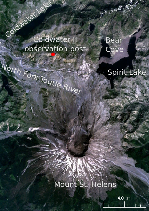
Mount St. Helens fumaroles reach 190 degrees at 6,906 feet elevation on the crater rim, emerging 159.1 degrees above ambient in the Gifford Pinchot National Forest. These intensely hot geothermal features require a 5.6-kilometer hike from Climber's Bivouac Road, occupying the volcano's post-1980 eruption crater.
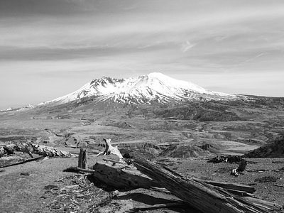
The fumaroles sit within the horseshoe-shaped crater created by the May 18, 1980 eruption that removed the volcano's north face. Annual precipitation totals 103 inches with 278.3 inches of snow. The landscape remains raw and actively evolving, with pumice fields, growing lava dome, and minimal vegetation. Views extend into the crater and across the blast zone.
Reaching the fumaroles requires a climbing permit from April through October, obtained through recreation.gov lottery. The hike gains significant elevation through pumice and boulder fields. Lower Falls Campground, 25 kilometers away, provides base camping. Monitor volcanic activity bulletins and weather forecasts. Bring sun protection, as the pumice slopes reflect intense radiation.
The 1980 eruption fundamentally transformed Mount St. Helens, removing 1,300 feet of elevation and creating the current crater. Ongoing geothermal activity reflects magma movement beneath the volcano, monitored continuously by the USGS Cascades Volcano Observatory. Climbing routes were reestablished in the 1980s as the mountain stabilized under Forest Service management.
Some links are affiliate links. We may earn a commission at no extra cost to you.
Overview Lower Falls Campground is located in the Gifford Pinchot National Forest. Visitors enjoy several waterfalls in the area and access to the Lewis River Trail. The campground is open from mid-May through October.Recreation Near the campground are several trailheads that provide visitors with a variety of recreational opportunities. There are hiking trails, mountain bike trails, horse trails, and motorcycle trails within 10 miles of the campground. The Lewis River contains rainbow, cutth...
Mt St Helens Fumaroles sits at 6,906 feet above sea level, way above the mile-high mark. You may not feel the altitude strongly, but hot water still dehydrates you faster at elevation. UV is about 28% stronger than at sea level, so bring sunscreen and drink more water than you normally would.


As an Amazon Associate, we earn from qualifying purchases.
Mt St Helens Fumaroles is road-accessible, so you can bring more gear. The water is dangerously hot — bring water shoes and test pools carefully. Cold air temperatures make a changing robe or warm layers essential.


As an Amazon Associate, we earn from qualifying purchases.
Springs Near Mt St Helens Fumaroles
More Springs Around 190°F
Hike 6 waterfalls near Mt St Helens Fumaroles
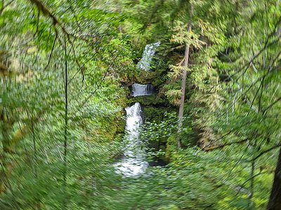
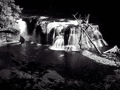
Looking for more outdoor adventures? Explore waterfall hikes near Mt St Helens Fumaroles, Washington.