Grapevine Spring
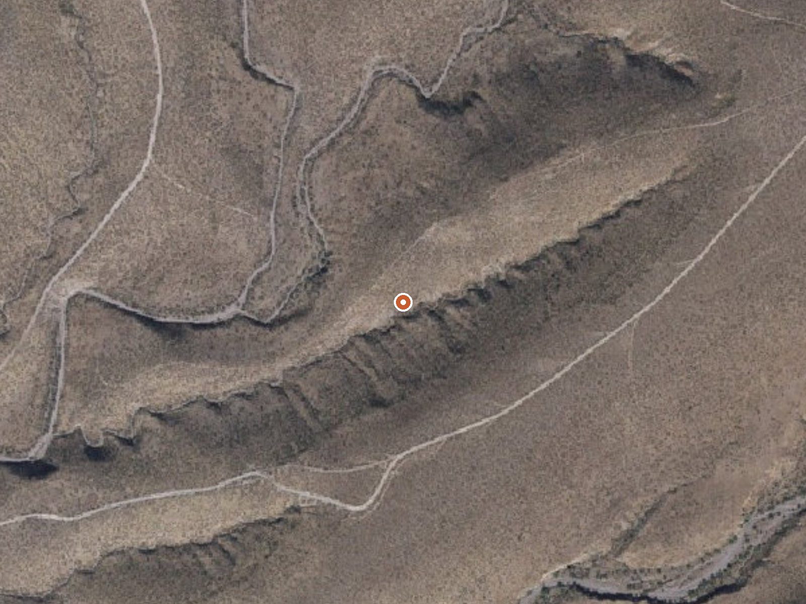
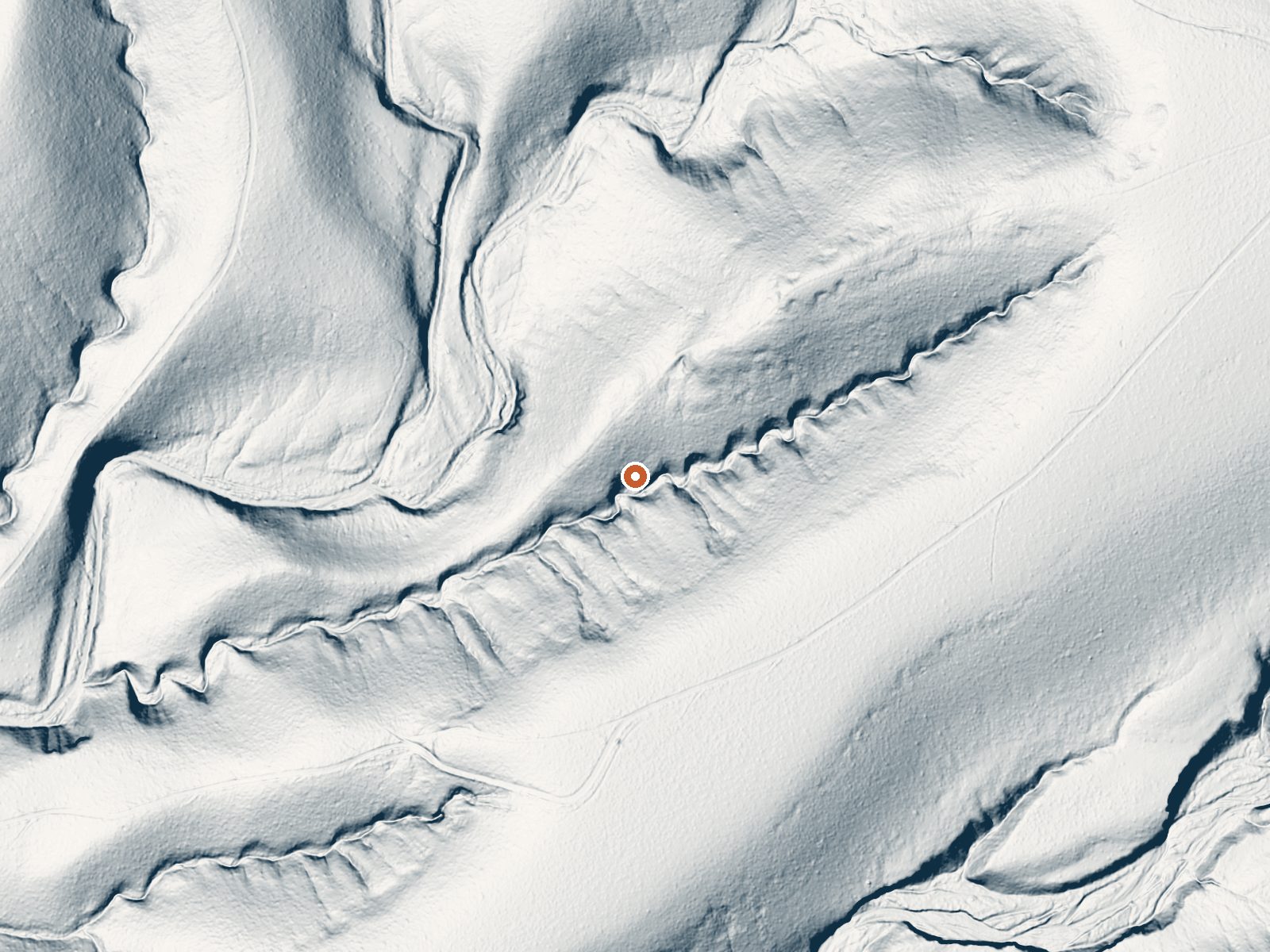
Drag the handle to compare the two views. The orange dot marks the spring, in a frame about three quarters of a mile wide.
Grapevine Spring is a warm spring on state trust land in Graham County, about nine miles from Pima. The water sits in the low nineties, on the cool side of soaking warm. Access is restricted. That restriction plus the SRMA designation means this is no place to turn up unannounced, and the record gives no hint of a pool or any development. The USGS lists the point with no chemistry attached.
An unnamed road passes within a tenth of a mile, a short walk. The spring lies in upland desert at a fair height, where a winter might leave a handful of inches of snow and an average year sits in the mid sixties with ten inches or so of rain. Arizona State Trust Land, SRMA. Riverview Campground, around nineteen miles off, is the nearest the record can name for camping.
December through February are the listed months. The walk from the road is trivial. Restricted access on trust land means a call to the state land office first; do not assume a permit is unnecessary. Riverview Campground, a long way out, is the camp on file. Nobody has noted a fee. The water is mild and carries no heat risk.
Aircraft with laser scanners measured this ground to within inches. The scan strips out trees and buildings, leaving the bare shape of the land around Grapevine Spring.
- Setting
- Hillside
- The spring sits on a steep slope that climbs to the east.
- Highest ground nearby
- 167 ft above the spring
- Within a quarter mile, to the east
A slice through the ground from southwest to northeast, about 0.6 miles end to end.
Elevation data: USGS 3D Elevation Program. Aerial imagery: USGS The National Map. Public domain.
That's about 1½ times the US average of 65. It's higher than at 25% of the springs on this site.
Heat flow measures the warmth working its way up through the ground from deep inside the earth. Where it runs high, rain and snowmelt that seep down through cracks in the rock come back up hot.
See every spring on the geothermal heat map →
Heat flow estimate: Stanford Thermal Earth Model (Aljubran & Horne, 2024), CC BY 4.0.
Some links are affiliate links. We may earn a commission at no extra cost to you.
Riverview Campground offers a fantastic camping experience in the Gila Box Riparian National Conservation Area and is a short drive from Safford, Arizona. It is situated on a northern bench overlooking the Gila River and is surrounded by various day use sites along the river. There are 13 first come, first served campsites at Riverview Campground. Each site has picnic tables, fire rings, grills, and shade structures. The campsites were recently enlarged to improve access for trailers and RVs....
Grapevine Spring is road-accessible, so you can bring more gear.




As an Amazon Associate, we earn from qualifying purchases.
Springs Near Grapevine Spring
More Springs Around 91°F
Hike 3 waterfalls near Grapevine Spring
Looking for more outdoor adventures? Explore waterfall hikes near Grapevine Spring, Arizona.