Geothermal Heat Map of US Hot Springs
Every hot spring on this site, plotted over a map of the heat rising through the ground. The warm colors mark where heat from deep in the earth reaches the surface fastest, and the springs crowd into them.
Tap a pin for the spring's water temperature and heat flow. Alaska and Hawaii springs are on the map without a heat flow value.
Why Hot Springs Crowd Into the West
Heat flow measures how much warmth works its way up from deep inside the earth, in milliwatts per square meter. Across the United States it averages about 65.
Most of the West runs well above that. The crust there has been stretched thin and broken by faults, which leaves hot rock closer to the surface. Rain and snowmelt sink down through those cracks and come back up hot.
The cool blue East has only a scattering of springs. Most of them, like the ones in Hot Springs, Arkansas, and Warm Springs, Virginia, come from water that circulates unusually deep before it surfaces.
The Hottest Ground and the Hottest Water
Heat flow at each spring, from the Stanford Thermal Earth Model.
- 1 Steamboat Springs Nevada 257 mW/m² 205°F water
- 2 Steamboat Springs Nevada 236 mW/m² 205°F water
- 3 Johnson Warm Spring Utah 200 mW/m² 77°F water
- 4 St Helena White Sulphur Spring California 199 mW/m² 97°F water
- 5 Utah Hot Springs Utah 198 mW/m² 138°F water
- 6 Fumarole California 197 mW/m²
- 7 Davis Soda Spring California 193 mW/m² 73°F water
- 8 White Sulphur Springs (California) California 192 mW/m²
- 9 Sulphur Bank California 191 mW/m² 156°F water
- 10 Calistoga Hot Springs California 191 mW/m² 172°F water
- 11 Anderson Springs, California California 191 mW/m²
- 12 Newman Springs California 186 mW/m² 94°F water
- 13 The Geysers California 186 mW/m² 214°F water
- 14 Unnamed spring California 186 mW/m² 120°F water
- 15 Unnamed spring California 183 mW/m²
- 16 Anderson Springs California 183 mW/m² 108°F water
- 17 Los Guilicos Warm Springs California 182 mW/m² 88°F water
- 18 Castle Rock Springs California 182 mW/m² 163°F water
- 19 Unnamed spring California 181 mW/m² 81°F water
- 20 Unnamed spring California 181 mW/m² 70°F water
- 21 Unnamed spring California 179 mW/m² 90°F water
- 22 Durfee Spring Idaho 179 mW/m² 102°F water
- 23 Harbin Springs California 178 mW/m² 120°F water
- 24 Quigley Soda Spring California 178 mW/m² 82°F water
- 25 Unnamed spring California 178 mW/m² 83°F water
Measured water temperature. Many of the hottest are geysers and boiling pools that nobody can soak in.
- 1 Sherman Crater Fumaroles Washington 266°F 79 mW/m² heat flow
- 2 Fumaroles On Kanaga Island Alaska 219°F
- 3 Hot Springs Near Geyser Bight Alaska 216°F
- 4 The Geysers California 214°F 186 mW/m² heat flow
- 5 Hot Springs Near Geyser Bight Alaska 214°F
- 6 Little Geysers California 210°F 177 mW/m² heat flow
- 7 (Soda Lake Area) Nevada 210°F 147 mW/m² heat flow
- 8 Bradys Hot Springs Nevada 209°F 167 mW/m² heat flow
- 9 The Needle Rocks Hot Spring Nevada 208°F 92 mW/m² heat flow
- 10 The Needle Rocks Hot Springs Nevada 208°F 92 mW/m² heat flow
- 11 Beowawe Hot Springs (The Geysers) Nevada 208°F 108 mW/m² heat flow
- 12 Hot Springs (Surprise Valley) California 208°F 91 mW/m² heat flow
- 13 Great Boiling Spring (Gerlach) Nevada 208°F 83 mW/m² heat flow
- 14 Lake City Hot Springs California 207°F 100 mW/m² heat flow
- 15 Devils Kitchen California 207°F 110 mW/m² heat flow
- 16 Coso Hot Springs California 207°F 116 mW/m² heat flow
- 17 Hot Springs Oregon 207°F 75 mW/m² heat flow
- 18 Leach Hot Springs Nevada 207°F 96 mW/m² heat flow
- 19 Hunters Hot Springs Oregon 205°F 127 mW/m² heat flow
- 20 Wendel Hot Springs California 205°F 81 mW/m² heat flow
- 21 Morgan Hot Spring California 205°F 110 mW/m² heat flow
- 22 Morning Mist Springs Wyoming 205°F 141 mW/m² heat flow
- 23 Flat Cone Spring, Steep Cone Wyoming 205°F 147 mW/m² heat flow
- 24 Steamboat Springs Nevada 205°F 236 mW/m² heat flow
- 25 Sulphur Hot Springs Nevada 205°F 123 mW/m² heat flow
Heat Flow Under Each State's Springs
Median heat flow at the springs in each state. The dashed line marks the US average of 65.
Geothermal Heat From Orbit
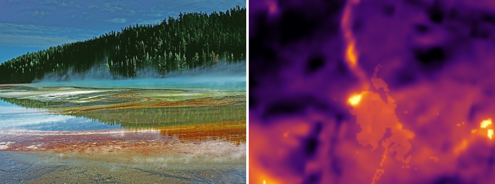
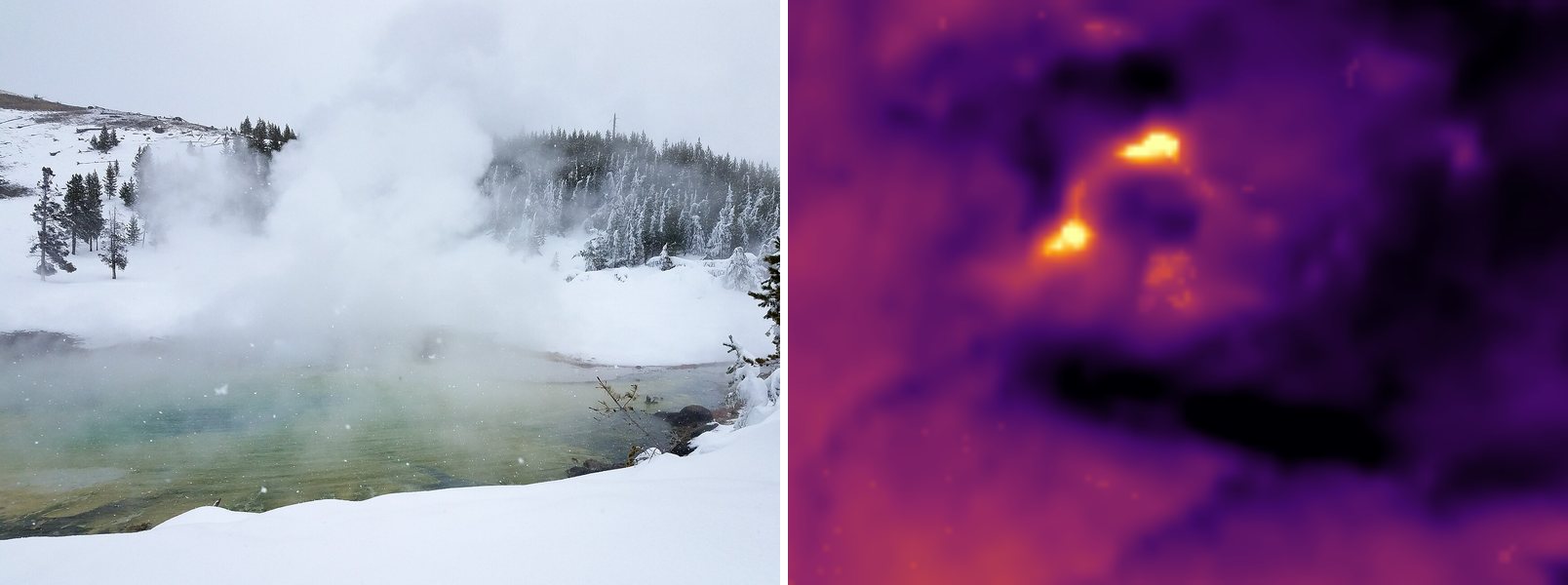
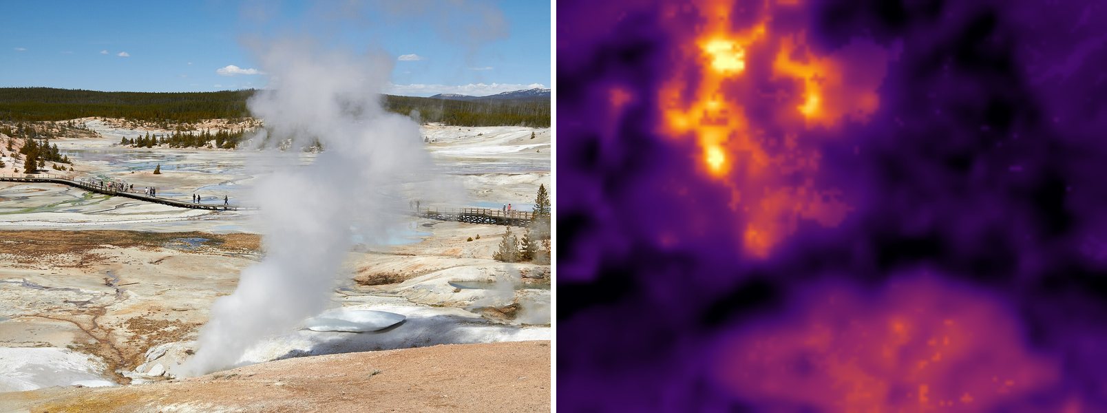
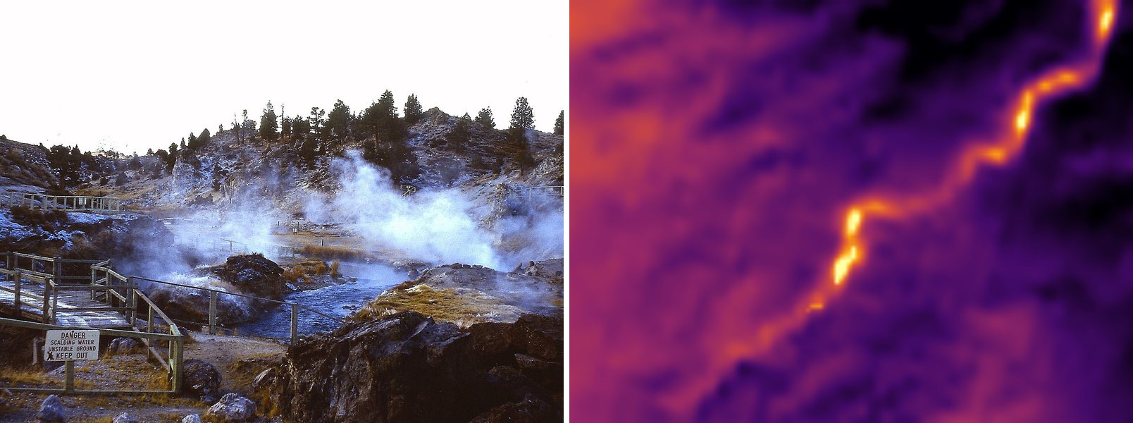
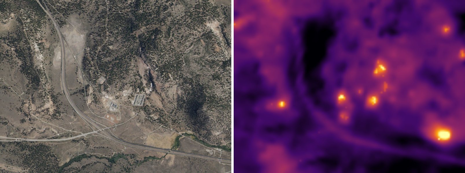
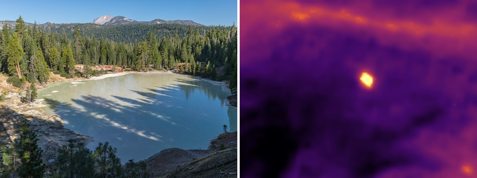
Landsat's thermal camera reads the temperature of the ground from about 440 miles up. On a clear winter day the biggest geothermal areas glow against the frozen land around them. Each card pairs a photo of the spring, or an aerial view where there's no good photo, with what the thermal camera saw.
 Photo
Thermal · Landsat
Photo
Thermal · Landsat
Midway Geyser Basin, home of Grand Prismatic Spring. The bright thread running through it is the Firehole River, which hot runoff keeps free of ice all winter.
Photo: Michael Gäbler, CC BY 3.0
 Photo
Thermal · Landsat
Photo
Thermal · Landsat
Two hot spots mark Imperial and Spray Geysers, tucked into the forest west of the Firehole in Lower Geyser Basin.
 Photo
Thermal · Landsat
Photo
Thermal · Landsat
Norris Geyser Basin is the hottest in Yellowstone, and the whole basin glows through the snow.
 Photo
Thermal · Landsat
Photo
Thermal · Landsat
Hot springs boil up in the bed of Hot Creek, so the stream below them stays warm and shows up as a glowing ribbon through the snow.
 Aerial · USGS
Thermal · Landsat
Aerial · USGS
Thermal · Landsat
Casa Diablo sits beside a geothermal power plant near Mammoth Lakes. The steaming ground and the plant show up as separate hot spots.
 Photo
Thermal · Landsat
Photo
Thermal · Landsat
A lake of hot water and boiling mud in Lassen Volcanic National Park. It stays near 125°F all year, warm enough to glow as one bright spot in a snowbound valley.
Heat flow: Stanford Thermal Earth Model (Aljubran & Horne, 2024), CC BY 4.0. It covers the lower 48 states. Thermal views: Landsat 8/9 surface temperature, USGS (public domain), via Microsoft Planetary Computer. Aerial views: USGS The National Map (public domain). Photos: Wikimedia Commons, credited on each card.