Petersons Mill Hot Spring

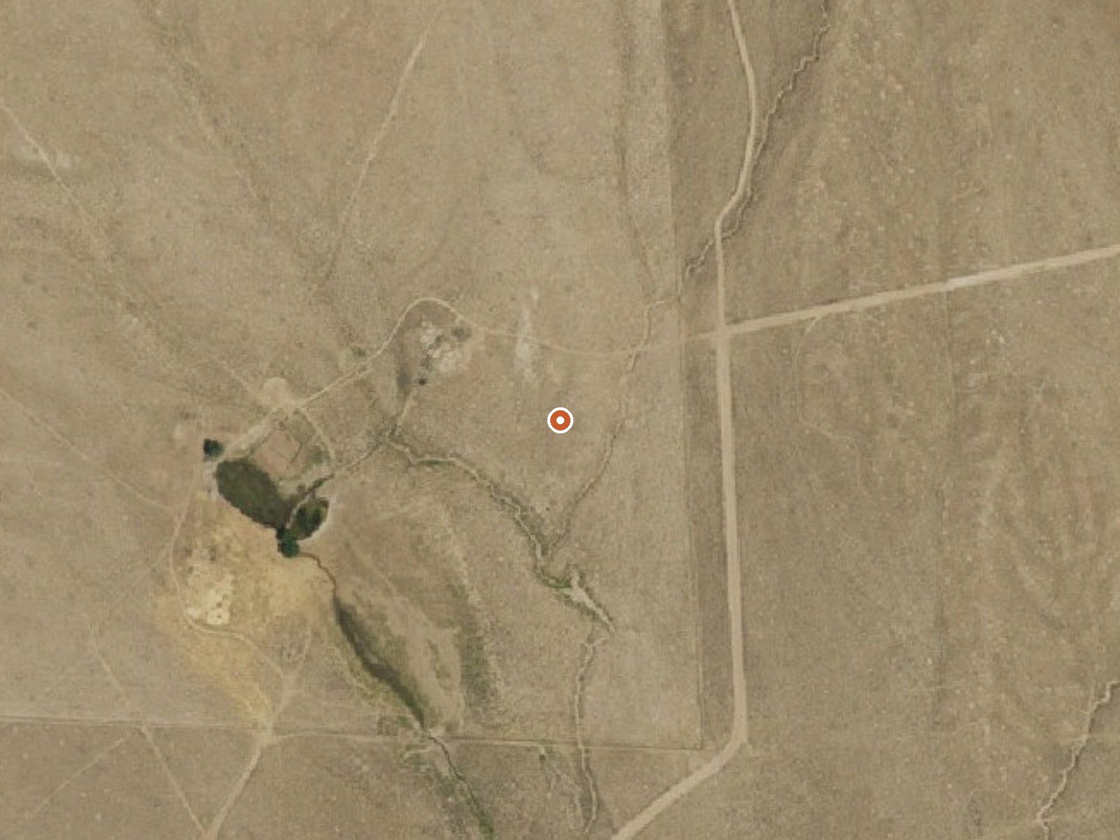
The orange dot marks the spring, in a frame about three quarters of a mile wide.
Can you soak at Petersons Mill Hot Spring?
USGS lists Petersons Mill Hot Spring as a hot spring, with no temperature on record. You can drive right up to it. We haven't confirmed whether it has a pool or charges a fee.
Petersons Mill Hot Spring is a remote thermal site in Lander County, nearly eighty miles from Battle Mountain, the closest town in the record. The record classes the water as hot and gives no measured temperature, so there is no way to say from here if it is soakable or scalding. No owner is named. Access status and USGS site number are both blank.
Roadside, a few hundred feet from a road that is unnamed on file. High country above six thousand feet, with a cool annual average and around four feet of snow a year. Twelve inches of precipitation. Nothing on file about ownership or designation. The elevation is the one hard fact here, and it means long, cold winters.
No best months are recorded. Snow totals here will shape when you can drive in. No campground is listed. Temperature and access are both unknown. So is ownership. Go to look, and do not count on a soak. The distance from Battle Mountain means fuel and water need planning.
USGS hasn't flown a detailed laser scan here yet, so this view comes from aerial photos and older elevation data.
- Setting
- Open ground
- Flat, open ground all around.
- Highest ground nearby
- 27 ft above the spring
- Within a quarter mile, to the north
A slice through the ground from south to north, about 0.6 miles end to end.
Elevation data: USGS 3D Elevation Program. Aerial imagery: USGS The National Map. Public domain.
That's close to the US average of 65. It's higher than at 14% of the springs on this site.
Heat flow measures the warmth working its way up through the ground from deep inside the earth. Where it runs high, rain and snowmelt that seep down through cracks in the rock come back up hot.
See every spring on the geothermal heat map →
Heat flow estimate: Stanford Thermal Earth Model (Aljubran & Horne, 2024), CC BY 4.0.
Petersons Mill Hot Spring sits at 6,344 feet above sea level, way above the mile-high mark. You may not feel the altitude strongly, but hot water still dehydrates you faster at elevation. UV is about 25% stronger than at sea level, so bring sunscreen and drink more water than you normally would.


As an Amazon Associate, we earn from qualifying purchases.
Springs Near Petersons Mill Hot Spring
Hike 1 waterfall near Petersons Mill Hot Spring
Looking for more outdoor adventures? Explore waterfall hikes near Petersons Mill Hot Spring, Nevada.