Mt Rainier Fumaroles
Mount Rainier fumaroles reach 162 degrees at 14,217 feet elevation, emerging 154.8 degrees above ambient at Washington's highest point. These geothermal features sit 70.6 meters from the Disappointment Cleaver Route within Mount Rainier National Park, where volcanic heat melts ice caves and steam vents in the summit crater.
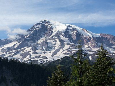
The summit occupies pure alpine terrain above 14,000 feet, surrounded by the mountain's 26 named glaciers. Annual precipitation reaches 95.3 inches with 418.5 inches of snowfall, though much accumulates as ice rather than melting. Average air temperature is 7.2 degrees. The crater rim offers 360-degree views across the Cascades, Puget Sound, and eastern Washington.
Reaching the fumaroles requires technical mountaineering experience, glacier travel skills, and climbing permits from Mount Rainier National Park. Most attempts occur June through September. Climbers typically spend one or two nights ascending from Paradise at 5,400 feet. Altitude, crevasses, rockfall, and weather create serious hazards. Cougar Rock Campground lies 9.8 kilometers from Paradise.
Rainier holds spiritual significance for the Puyallup, Nisqually, and other Coast Salish peoples who knew the mountain as Tahoma or Tacoma. Summit fumaroles indicate ongoing volcanic activity beneath the heavily glaciated stratovolcano. The Disappointment Cleaver route became the standard climbing route after Hazard Stevens and P.B. Van Trump completed the first recorded summit in 1870.
Some links are affiliate links. We may earn a commission at no extra cost to you.
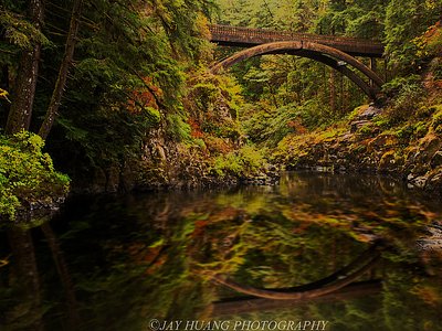
Overview Cougar Rock Campground, on the southwest side of Mt. Rainier National Park, is conveniently located near Paradise. Individual campsites are reservable on this page. Group campsite reservations can be made via Cougar Rock Group Campground. Paradise is the most popular destination in the park, with a lodge and visitor center, many miles of hiking trails and a commanding view of the mountain-the highest in the state and Cascade range. The main attraction at Mount Rainier National Park...
Mt Rainier Fumaroles sits at 14,217 feet — well above 10,000 ft where the air holds roughly 30% less oxygen than at sea level. Altitude sickness (headache, nausea, dizziness) is a real risk, especially when combined with the dehydrating effects of hot water. UV exposure is approximately 57% stronger than at sea level. Acclimate for at least 24 hours before soaking, drink extra water, and descend if symptoms worsen.


As an Amazon Associate, we earn from qualifying purchases.
Mt Rainier Fumaroles is road-accessible, so you can bring more gear. The water is dangerously hot — bring water shoes and test pools carefully. Cold air temperatures make a changing robe or warm layers essential.


As an Amazon Associate, we earn from qualifying purchases.
Springs Near Mt Rainier Fumaroles
More Springs Around 162°F
Hike 6 waterfalls near Mt Rainier Fumaroles

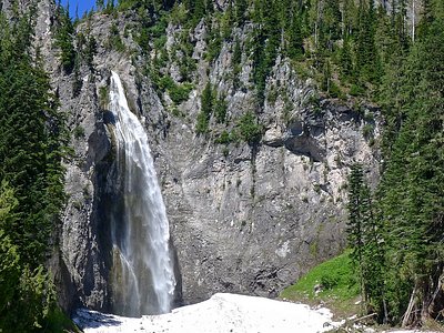
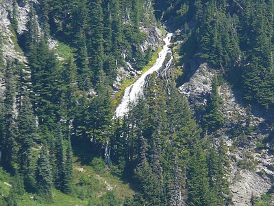
Looking for more outdoor adventures? Explore waterfall hikes near Mt Rainier Fumaroles, Washington.